Central Menomonee Valley
Prior to European incursion, the Menomonee Valley was bracketed by wooded cliffs on both its northern and southern edges. The Menomonee River flowed naturally through this valley, a predominately wetland area that extended from the confluence of the Milwaukee River to the area just east of the current Brewer’s Boulevard.
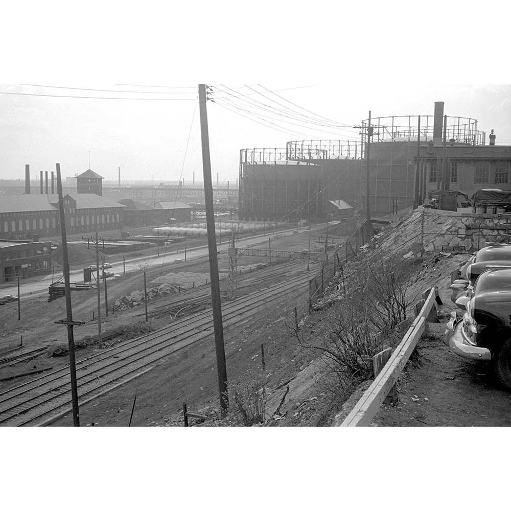
The image in the viewer is the Milwaukee Gas Light Company’s West Side Works, as it appeared in 1953. In 1902, architect Alexander Eschweiler secured a contract for the construction of the west side production facility in the Menomonee Valley. The plant converted coal into natural gas for residential and industrial customers, including the City of Milwaukee’s streetlamps. To the left, across the Milwaukee Road railroad tracks, are two of the three large capacity gas storage tanks. The group of buildings between the railroad tracks and the Menomonee River comprise the main structures of the facility. On the far left is the two-story structure that housed the office, a laboratory, and two warehouse spaces. Moving to the right is the condenser building, the engine and ammonia storage building (with tower), and the purifier building. In 1959, the plant was decommissioned and the complex sat mostly vacant until 2016 when the Gohsman brothers turned the space into City Lights Brewing Company. The other current occupants of the former facility are Milwaukee Four Season’s Skate Park and Harwood Engineering Consultants Ltd.
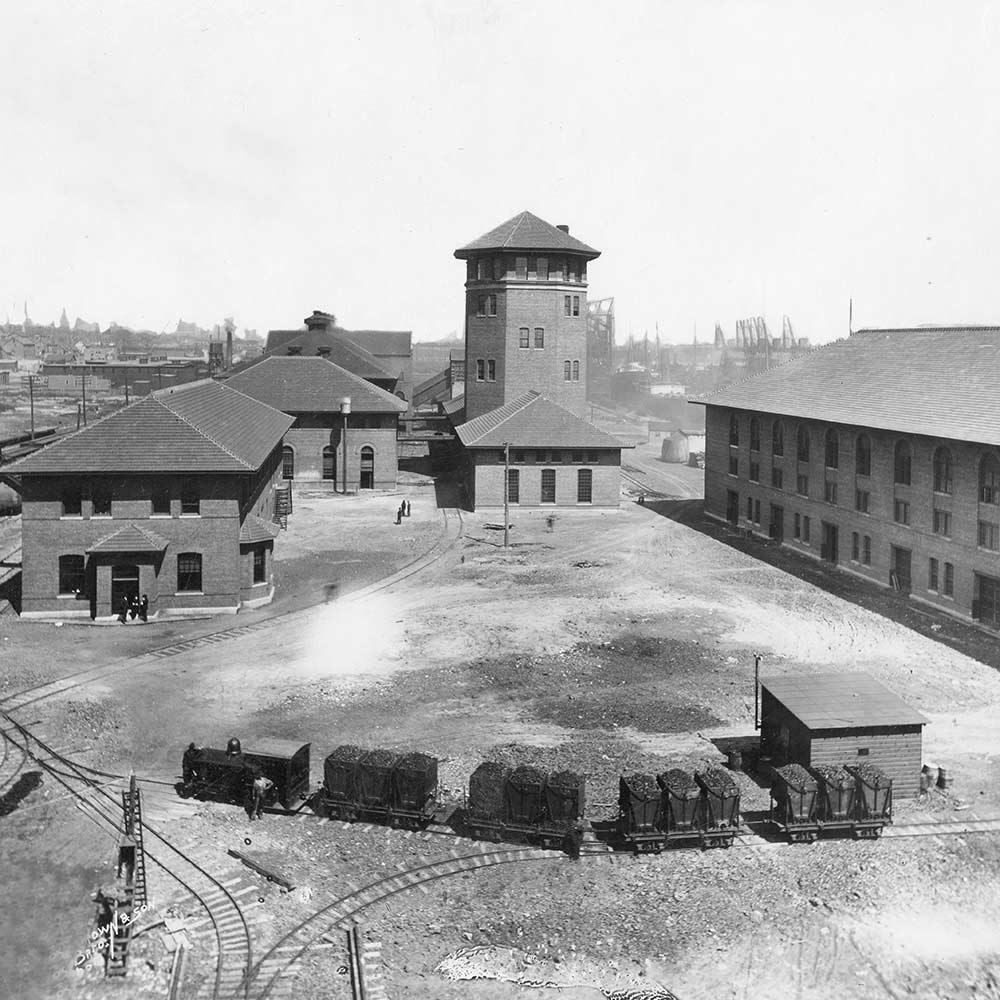
The Menomonee Canal is on the far right of the image. Prior to European incursion, the Menomonee Valley was bracketed by wooded cliffs on both its northern and southern edges. The Menomonee River flowed naturally through this valley, a predominately wetland area that extended from the confluence of the Milwaukee River to the area just east of the current Brewer’s Boulevard. Rich in natural flora, including wild rice, and home to a variety of fish and wildlife, the area was inhabited by both the Menomonee and Potawatomi peoples. The forced relocation of the native people by 1838 and the arrival of the first Yankee and European settlers began a process of transformation for the Menomonee Valley. Shortly after the “Straight Cut” of 1857, which created a straight entrance to the Milwaukee River from Lake Michigan, the Menomonee River was dredged for Lake Michigan ship traffic. By the late 1860’s, the increased volume of Great Lakes shipping brought even more change to the Valley. The Menomonee Improvements project from 1869 to 1873 saw the conversion of the Menomonee River into the North Menomonee Canal, the completion of two other canals, the South Menomonee and the Burnham’s canals, and the construction of 13,700 feet of additional dock space. Two additional private canals were built, the Kneeland and the Holton, and all the canals were dredged to a depth of twenty feet. From the latter half of the 19th century until well into the 20th century, the area between the 16th Street Viaduct and the 27th Street Viaduct was dominated by massive piles of coal, and large, rail operated coal cranes as seen in the viewer image.
 Milwaukee Gas & Light, 1904
 Seen from Clybourn
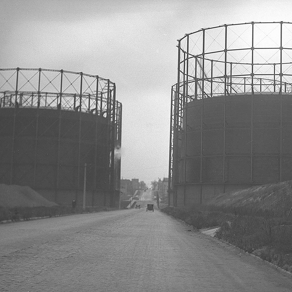
 St. Paul between Tanks
CURRICULUM:
Learn more with Viewaukee curriculum for the home or classroom.
